The neighborhood
Wheat Ridge, and why people stay
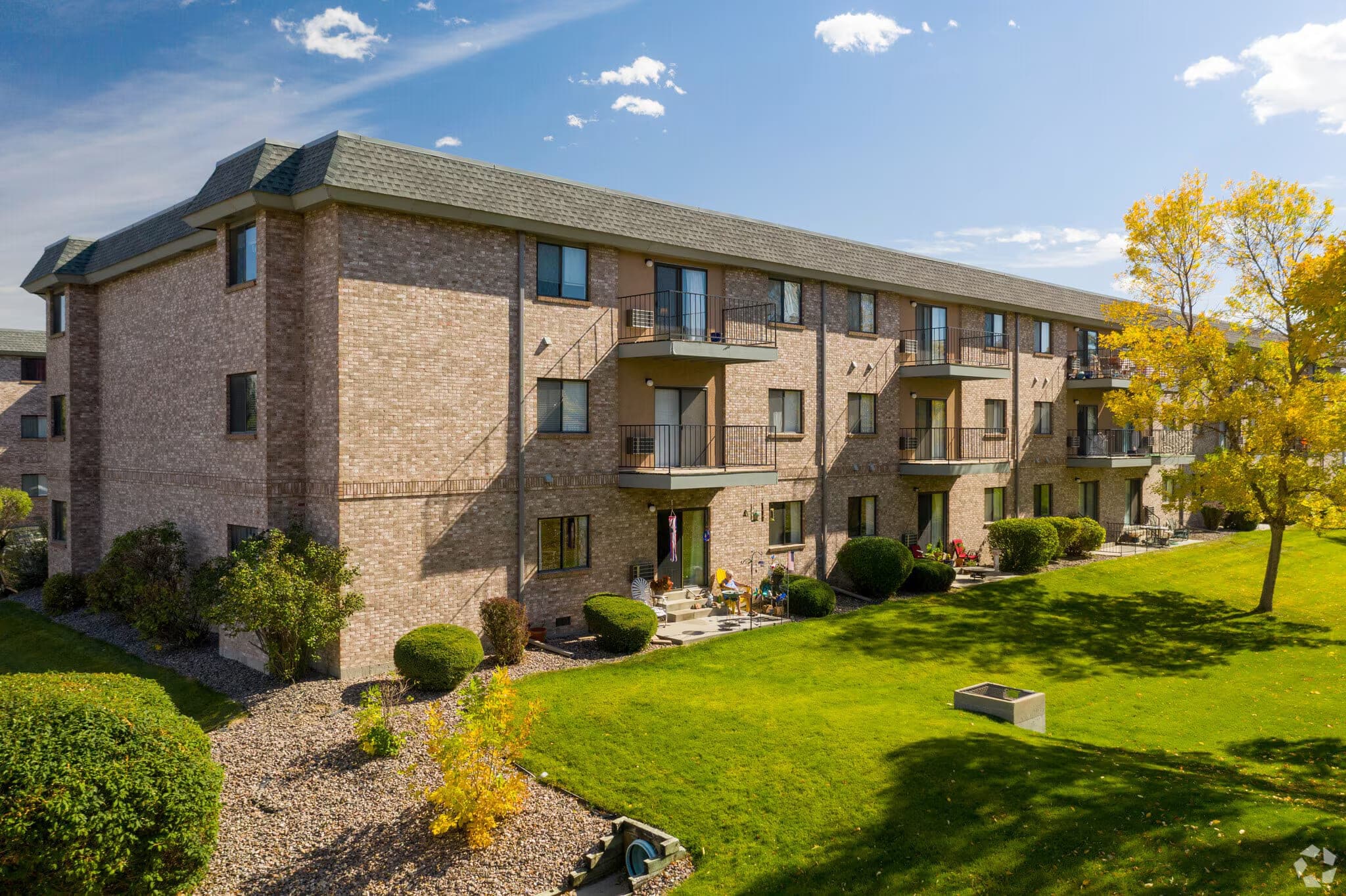
Morningside is on a quiet residential street, but not an isolated one. Most of what you need day to day is within a few minutes, and the mountains are visible from a good many balconies.
Worth knowing
The new hospital changed the map
Lutheran Hospital spent decades near 38th and Wadsworth, a few blocks from here. In August 2024 it moved to a new campus at Clear Creek Crossing, 12911 W. 40th Avenue, roughly three and a half miles west of the old site.
From Morningside that is about four miles — a short drive, and closer to a brand-new Level II trauma centre than most senior housing in this metro manages. If you are reading older listings about this area, note that any reference to the hospital’s old location is now out of date.
Where we are
3630 Vance St, Wheat Ridge, CO 80033
Off Vance Street in a residential part of Wheat Ridge, in Jefferson County, inside the 80033 ZIP code and the Jeffco Public Schools attendance zone. The community is three buildings — 3610, 3630 and 3650 — set back from Wadsworth between Upham and Vance.
Open in Google Maps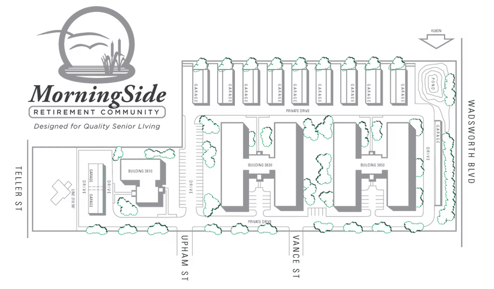
Time and distance
How far is everything, exactly
Measured from the building. Where something is genuinely walkable it says walk; where it is not, it says drive — including the light rail, which is not within walking distance and which no amount of marketing can move closer.
Shops and groceries
Three shopping centres within a third of a mile — close enough that a carton of milk does not need the car.
| Place | Time | Distance |
|---|---|---|
| Shops at West 38th | 3 min | 0.2 mi |
| The Ridge at 38th | 4 min | 0.2 mi |
| Corners at Wheat Ridge | 5 min | 0.3 mi |
Health care
Three hospitals within seven miles, including a Level II trauma centre built in 2024.
| Place | Time | Distance |
|---|---|---|
| Lutheran Hospital, Clear Creek CrossingListing sites still show this hospital 0.7 miles away. That was the old campus at 38th and Wadsworth, which it left in August 2024. | 10 min | 4 mi |
| OrthoColorado Hospital, St. Anthony Medical Campus | 11 min | 6.6 mi |
| St. Anthony Hospital | 11 min | 6.7 mi |
Parks and recreation
The Wheat Ridge Active Adult Center is a mile away and is the reason a good many residents never join a gym.
| Place | Time | Distance |
|---|---|---|
| Wheat Ridge Active Adult Center | 19 min | 1 mi |
| Crown Hill Park | 4 min | 1.9 mi |
| Clements Community Center | 4 min | 2.2 mi |
| Landry’s Downtown Aquarium | 11 min | 4.7 mi |
| Children’s Museum of Denver | 13 min | 4.9 mi |
Light rail
RTD’s W Line runs into Union Station. None of these is walkable, which is the honest answer — all are a short drive or a bus ride.
| Place | Time | Distance |
|---|---|---|
| Lakewood / Wadsworth station | 5 min | 3 mi |
| Lamar station | 7 min | 3.3 mi |
| Garrison station | 7 min | 3.5 mi |
| Sheridan station | 8 min | 4.1 mi |
| Oak station | 9 min | 4.5 mi |
Commuter rail and the airport
Olde Town Arvada puts you on the G Line; the airport is under 40 minutes door to door.
| Place | Time | Distance |
|---|---|---|
| Olde Town Arvada, westbound | 5 min | 2.3 mi |
| Olde Town Arvada, eastbound | 6 min | 2.5 mi |
| Arvada Ridge station | 8 min | 3.8 mi |
| 60th & Sheridan, Arvada Gold Strike | 9 min | 4.2 mi |
| Denver International Airport | 37 min | 28.5 mi |
Getting around
Including the scores that are not flattering
Independently scored by Local Logic. The transit score is the one worth reading twice: if you are hoping to give up the car entirely, 30 out of 100 is the honest warning that Wheat Ridge is not yet that place. This is also why a garage comes with every apartment.
- Very drivable
- 80/ 100
- Drivability
- Moderately walkable
- 60/ 100
- Walkability
- Fairly bikeable
- 50/ 100
- Bikeability
- Limited public transit
- 30/ 100
- Transit
What is nearby
Groceries and pharmacies
- Several full grocery stores within a few minutes’ drive along 38th and Wadsworth
- Pharmacies attached to the major stores, most with delivery
- Wheat Ridge farmers market in season
Health care
- Lutheran Hospital at Clear Creek Crossing, about four miles west
- Primary care and specialist offices clustered near the hospital campus
- Urgent care within a short drive
Outdoors
- Clear Creek Trail — flat, paved and walkable, following the creek
- Crown Hill Park and its lake, with level loop paths
- Prospect Park and the Wheat Ridge Greenbelt
- Anderson Park and the Wheat Ridge Recreation Center
Getting around
- RTD bus service along the main corridors nearby
- I-70 a few minutes north for the mountains
- Roughly 20 minutes to downtown Denver outside rush hour
- Golden, and the foothills, about fifteen minutes west
Distances and travel times above are measured from the building and are approximate — traffic on Wadsworth is the main variable. If somewhere that matters to you is not listed, ask the leasing office and they will measure it.
Come and see the street
A neighborhood is hard to judge from a map. Drive it, walk a block of it, and see whether it feels like somewhere you would live.